LOCATION
Manitoba, Canada
SIZE
30,682 ha
STAGE
Grassroots
DEPOSIT TYPE(S)
Magmatic Ni-Cu
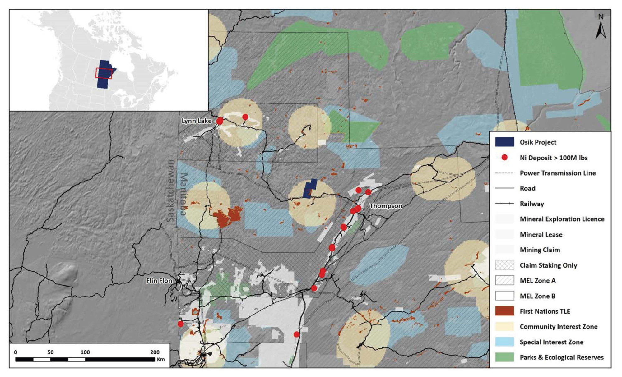
The Osik Project covers 30,682 hectares of Mineral Exploration Licenses (MELs) ~75 km’s to the northeast of Thompson, Manitoba. It represents a prospective area adjacent to the world class Thompson Nicle Belt (TNB), a globally top 10 nickel sulphide district. The area covered by the MELs has seen no meaningful greenfields exploration, where new exploration technologies and methodolofies can be applied within a Project with excellent infrastructure and a jurisdiction with a long mining history.
Location and Access
The Osik Project is ~75 km’s to the northeast of Thompson, Manitoba. The Property is transected by Provincial Highway 391 with access extending onto the property through a series of logging roads. The Thompson region has a long history of mining and resource development and offers good mining infrastructure.
Geology and Mineralisation
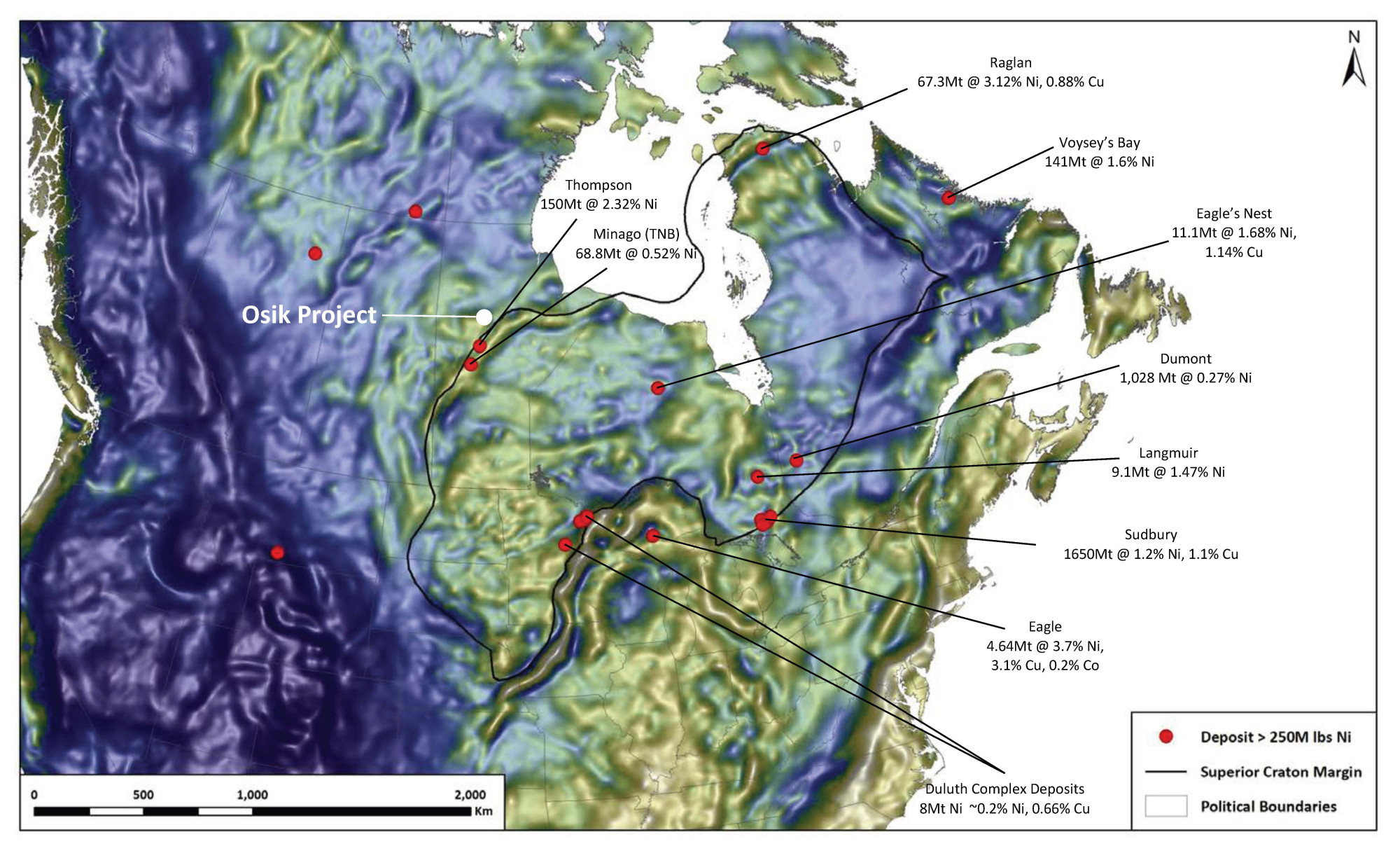
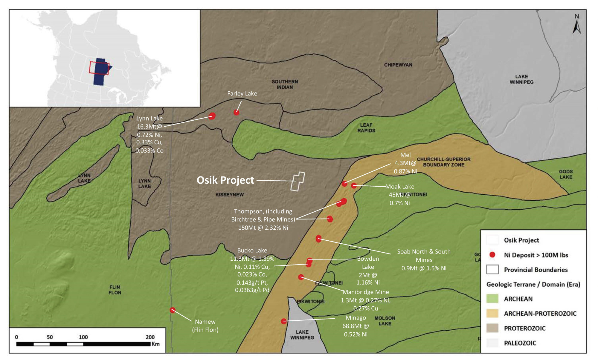
The Osik Project is composed of 30,682 hectares of the Paleoproterozoic Kisseynew Domain, a crustal scale rift which intersects the Thompson Nickel Belt and is temporally correlative to the Lynn Lake Nickel field. Manitoba’s Thompson Nickel Belt (TNB) is one of the top ten nickel producing districts globally with a total resource endowment of ~150Mt at 2.32% nickel. After Sudbury, TNB is the 2nd largest nickel district in Canada, with the deposits falling in the upper percentiles of nickel grade and tenor. Osik could represent a potential extension of the TDB district.
A three-pronged mineral system approach adapted from McCuaig & Hronsky (2014) was used for identifying Project area, integrating favorable lithospheric architecture, fertility and transient geodynamics. Regional geophysical datasets illustrate the Project covers a craton margin & associated intra-cratonic rift, which is a 1st order controlling factor for Nickel sulfide deposits globally. The fertility of this margin is proven as it is associated with other nickel camps such as Thompson, Lynne Lake and the Fox River Belt.
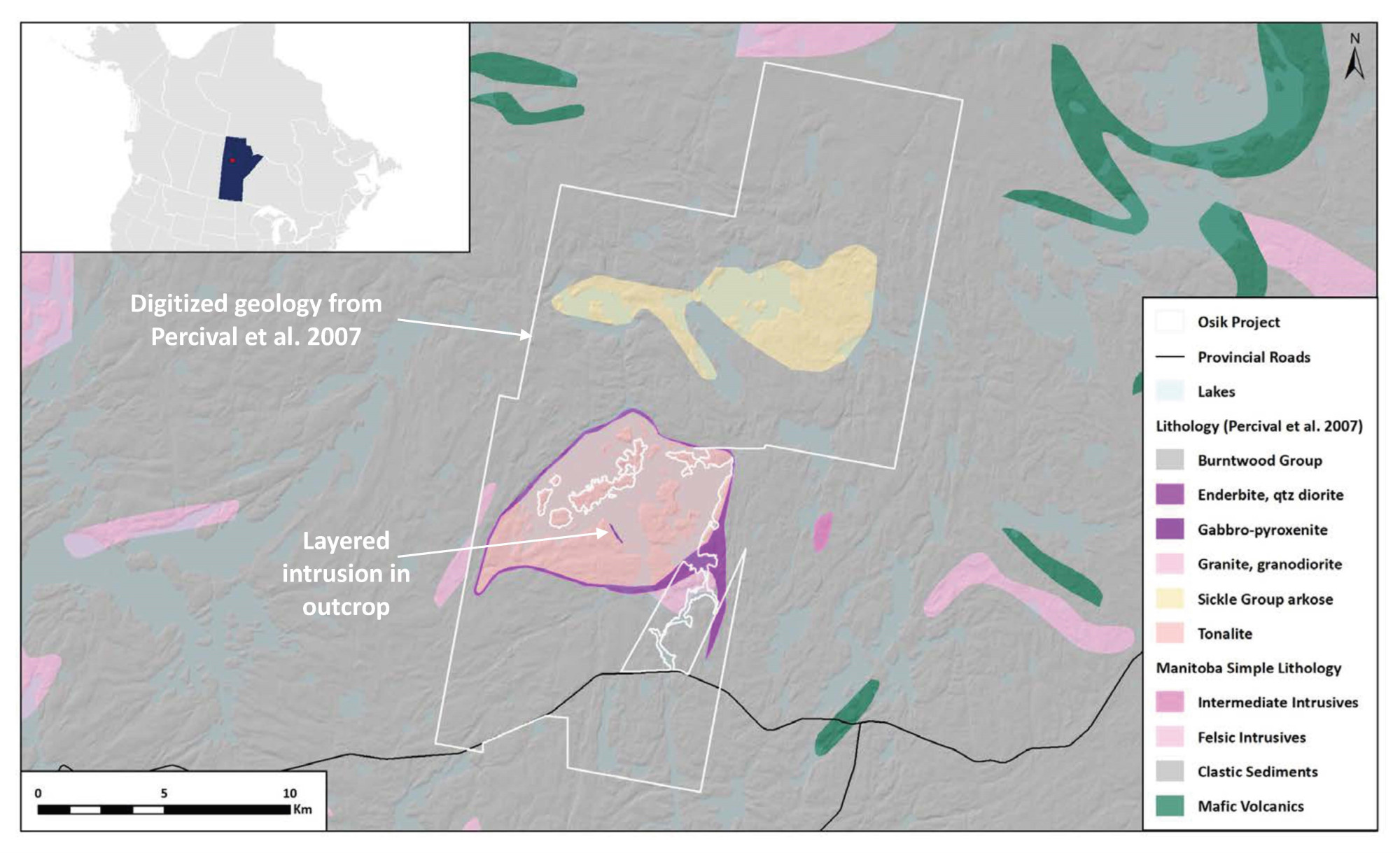
The work of Zwanzig (2000) demonstrates that Molson aged mafic rocks of the Kisseynew Domain were emplaced in a marginal basin on Archean basement with geochemical characteristics analogous to Lynn Lake and the TNB. Sedimentary units originally mapped as Burntwood contain silicate facies fe-formation, similar to the fertile Ospwagan Group sediments of the TNB. Percival et al (2007) mapped mafic to ultra-mafic layered intrusive rocks on the shoreline of Osik Lake. Magnetics, mapping and geology from historical drilling have also identified potential for large scale mafic to ultra-mafic layered intrusive rocks, indicating mantle derived fluid flux within the Project area.
Exploration History
The Project area has seen very little exploration with only two small drill campaigns and regional till sampling completed by the GSC. An extensive Ni-Cr anomaly was delineated by a GSC till sampling program in the Osik Lake area, including up to 2400ppm nickel in <2um till geochemistry samples and up to 1100ppm Ni and 1300ppm Cr in <63um samples. 8 diamond drill holes targeting EM anomalies were completed in the Osik Lake area by Canmine Resources in 1998. Assays did not return any highly anomalous nickel values, but up to 0.1 g/t Pd and 0.37 g/t Pt were returned. Nickel values were not particularly anomalous (30m at 0.22% nickel in silicate rocks), but MgO values were consistently high, running up to 44% MgO, indicative of hot, primitive magmas.
Summary of exploration activities conducted by Kenorland Minerals
LIDAR was flown by Kenorland in 2022, supporting that surficial geology on the property dominantly consists of a thin veneer of till on top of bedrock. The original Osik anomaly was followed up with prospecting which showed many ultramafic boulders are present that lead back to Osik Lake. 3D Magnetic Vector Inversions (MVI) were performed on magnetic data from the 1993 SPECTREM survey. Further processing identified clusters of strong magnetic vector anomalies in both the north and south regions of the Project area, with the southern anomalies being spatially associated with nickel in till. No drilling has been conducted in areas with strong vector anomalies.


