LOCATION
Quebec, Canada
SIZE
19,262 ha
STAGE
Grassroots
DEPOSIT TYPE(S)
Au-VMS, Intrusion-related Au, Orogenic Au
The Hunter Project covers 19,262 hectares of mineral tenure over a felsic volcanic complex within the southern Abitibi Greenstone Belt (AGB). These felsic-dominant volcanic complexes are highly prospective for syn-volcanic, Au-VMS type systems such as the world-class Horne and LaRonde deposits. The property is dominantly covered by glacial till and lake sediments, resulting in sparse bedrock exposure with very little systematic exploration due to the challenges of exploring through thick glacial sedimentary cover.
The Hunter Project is held under option to joint venture agreement with Centerra Gold Inc. Pursuant to the agreement, Centerra can earn an initial 51% interest in the Project by incurring an aggregate of $5,000,000 in mineral exploration expenditures on or before the fourth anniversary of the agreement. Centerra can then earn an additional 19% interest in the Project, for an aggregate 70% interest held, by completing a technical report that establishes a mineral resource of at least one million ounces of gold equivalent on or before the fourth anniversary of the exercise of the First Option, provided that Centerra must provide notice of its intent to exercise the Second Option within 90 days of the exercise of the First Option. Following the earning of a 70% interest, Centerra and Kenorland will form a joint venture in respect of the Project. In the event a joint venture participant’s interest is diluted to below 10%, it will exchange its joint venture interest for a net smelter returns royalty of 2% on currently unencumbered claims and 1.5% on claims currently encumbered by an existing royalty.
Location and Access
The Project is located approximately 20 kilometres south of the town of La Sarre, Quebec with provincial Highway 393 crossing the eastern portion of the property. A network of provincial and private roads provides excellent access throughout the property.
Geology and Mineralisation
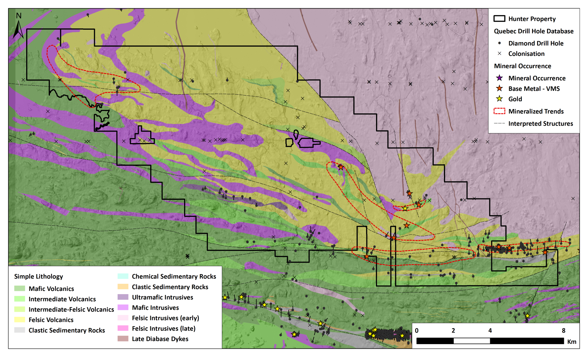
The Hunter Project covers a large package of calc-alkaline mafic to felsic volcanic rocks belonging to the Deloro Complex as well as approximately 20 kilometres of strike along the upper geological contact between the Deloro and the Stoughton-Roquemarue tholeiitic complex, which represents a transition into a rifted arc setting. Within the Abitibi Greenstone Belt this transitional geologic contact is spatially associated with many large VMS deposits. VMS systems which formed along rifted arcs are recognized to contain higher precious metal enrichment than other VMS systems which are base metal enriched.
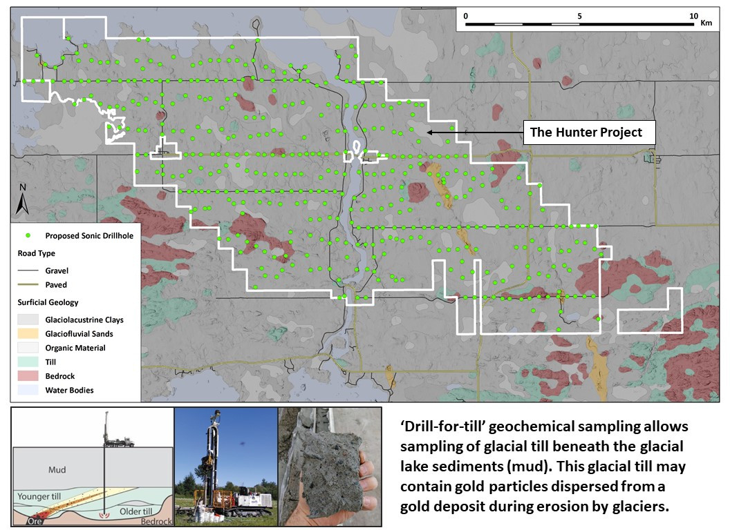
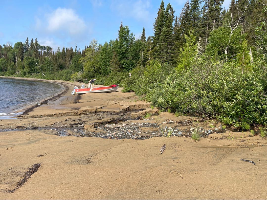
The Hunter Project is located within the Abitibi Clay Belt, an area blanketed by glaciolacustrine clays (glacial lake sediments) which hinder traditional surficial geochemical exploration. The clay belt represents a vast area of prospective geology which has seen very little systematic geochemical exploration. Despite this, glacial till samples from limited reverse circulation (RC) overburden drilling have returned gold in heavy mineral concentrate values within the top 98th percentile for all samples digitized throughout the AGB by Kenorland Minerals (proprietary data). These results strongly suggest that there is a local gold-in-bedrock source. Poly-metallic Cu-Au-Mo showings containing values of up to 100 g/t Au further highlight the prospectivity of the area.
Exploration History
There has been very little historical exploration within the Hunter Project area. Surficial exploration included limited reverse circulation drill-for-till completed by Overburden Drilling Management (ODM) between 1986 and 1989. In terms of diamond drilling, a total of 169 diamond drill holes have been located on the property, 48 of which were part of a water-well program in the northern Abitibi region in the 1960’s and 1970’s. Of the remaining 121 drill holes, 30 of these were completed directly on strike of the historical Hunter VMS mine. The remaining 91 diamond drill holes were sparsely distributed across the property, mostly targeting bedrock conductors from MEGATEM data.
Summary of exploration activities conducted by Kenorland Minerals
In 2019, the Company acquired the property through map staking after completing a comprehensive compilation and review of historical exploration data covering the Project area.
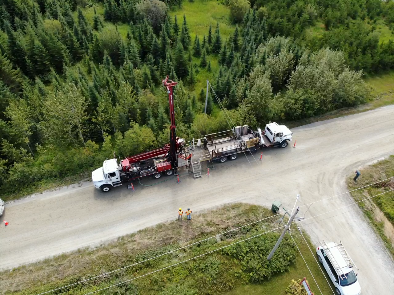
In early, 2020 the Company completed 5 sonic drill-for-till holes to confirm the presence of elevated gold anomalism in the glacial till cover identified from historical data compilation. In August 2021, the Company completed a property-wide airborne Versatile Time Domain Electromagnetic (VTEM) geophysical survey aimed to identify potential volcanogenic massive sulphide (VMS) targets for follow-up exploration. A total of 1,104 line-kilometres were flown at a spacing of 200m.
In 2022, a property-wide drill-for-till sonic program was completed. Kenorland carried out a detailed drone magnetic survey in spring 2023.
A detailed winter sonic overburden drill-for-till program was completed in early March 2024 and was comprised of 160 drillholes covering priority target areas identified from the initial regional program completed in 2022. Potential targets include Cu-Au-Ag VMS and orogenic Au mineralised systems.
On March 17, 2025, Kenorland announced the commencement of the maiden drill program at the Hunter Project in Quebec, with up to 4,300 meters of diamond drilling planned as part of the Winter 2025 exploration campaign.


