LOCATION
Quebec, Canada
SIZE
25,333 ha
STAGE
Available
DEPOSIT TYPE(S)
Li-Cs-Ta Pegmatite
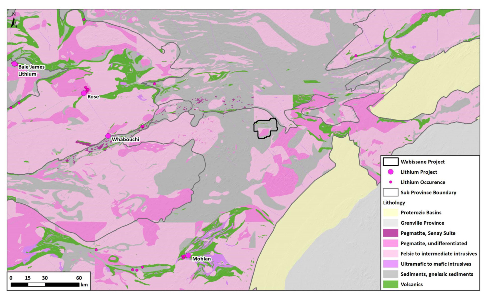
Acquired through staking in March 2023, the 25,333 ha Wabissane Project lies within Opatica sub-province of Archean Superior Craton in Quebec. The Project is proximal to a sub-province boundary and hosts elevated Li-Cs in lake sediment geochemistry coincident with pegmatitic granitoids. The Project represents under-explored potential in a district active for Lithium-Cesium-Tantalum (LCT) pegmatite exploration, hosting major Li Projects such as James Bay Lithium (Allkem), Rose (Critical Elements), Whabouchi(Nemaska Lithium), and Moblan(Sayona). The Wabissane Project represents an excellent opportunity for grassroots, district-scale discovery LCT pegmatites in a favourable jurisdiction.
Location and Access
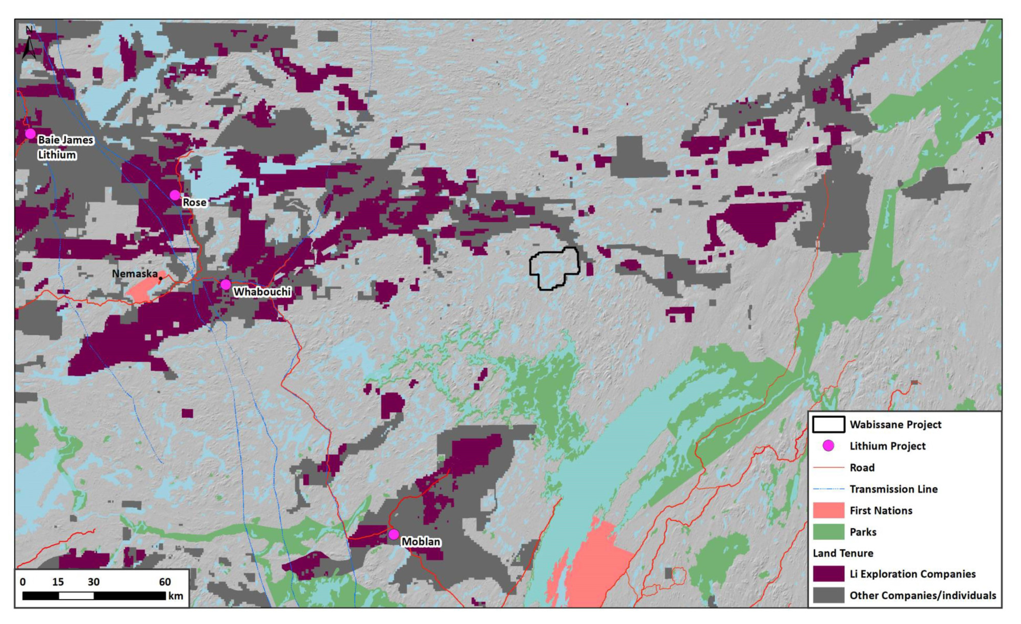
The Wabissane Project is located ~140km north of the town of Mistissini, 100km from both Route Du Nord and Renard Mine road in Quebec, Canada. The area encompasses a favourable jurisdiction with no restrictions on mining activity.
Geology and Mineralisation
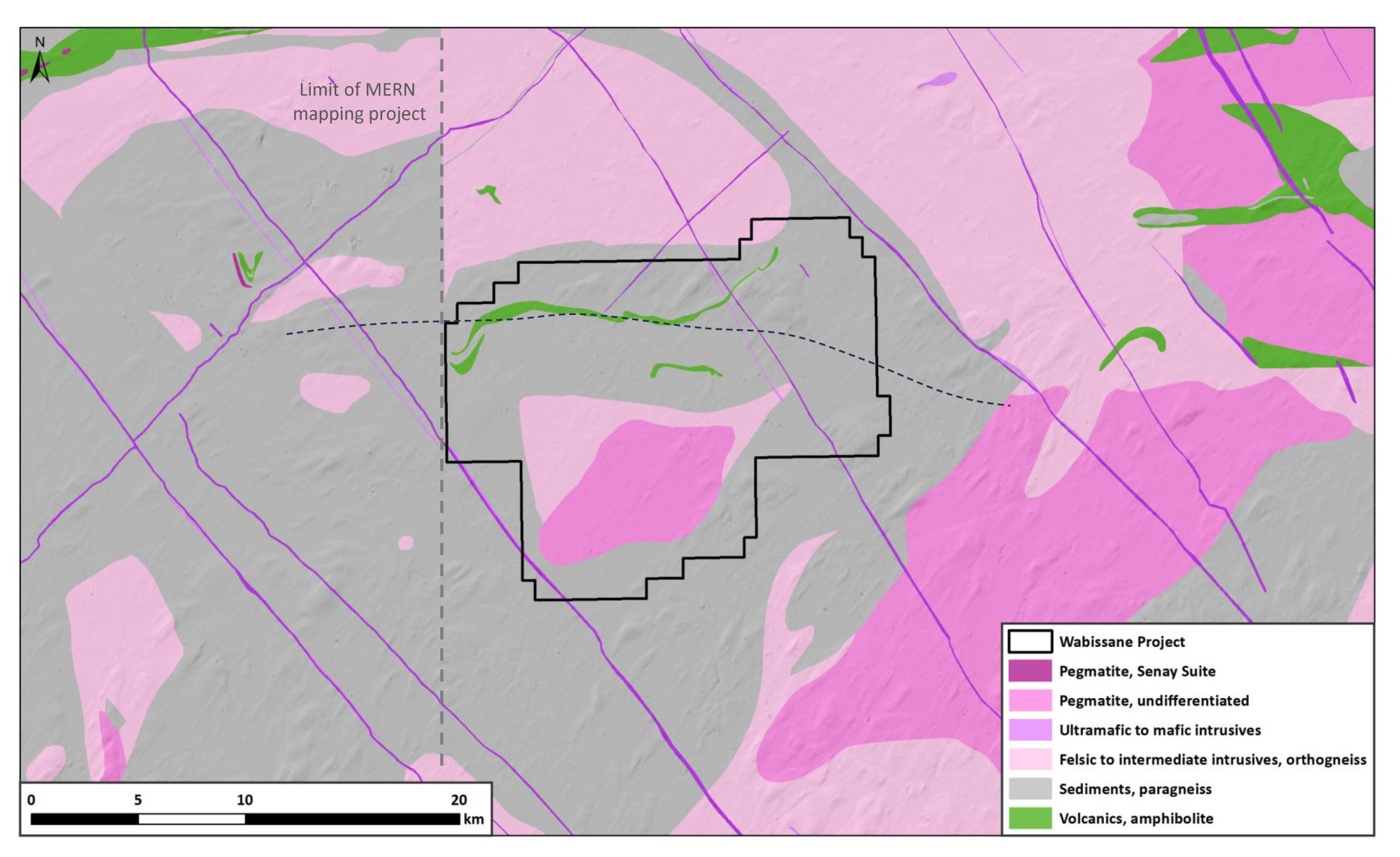
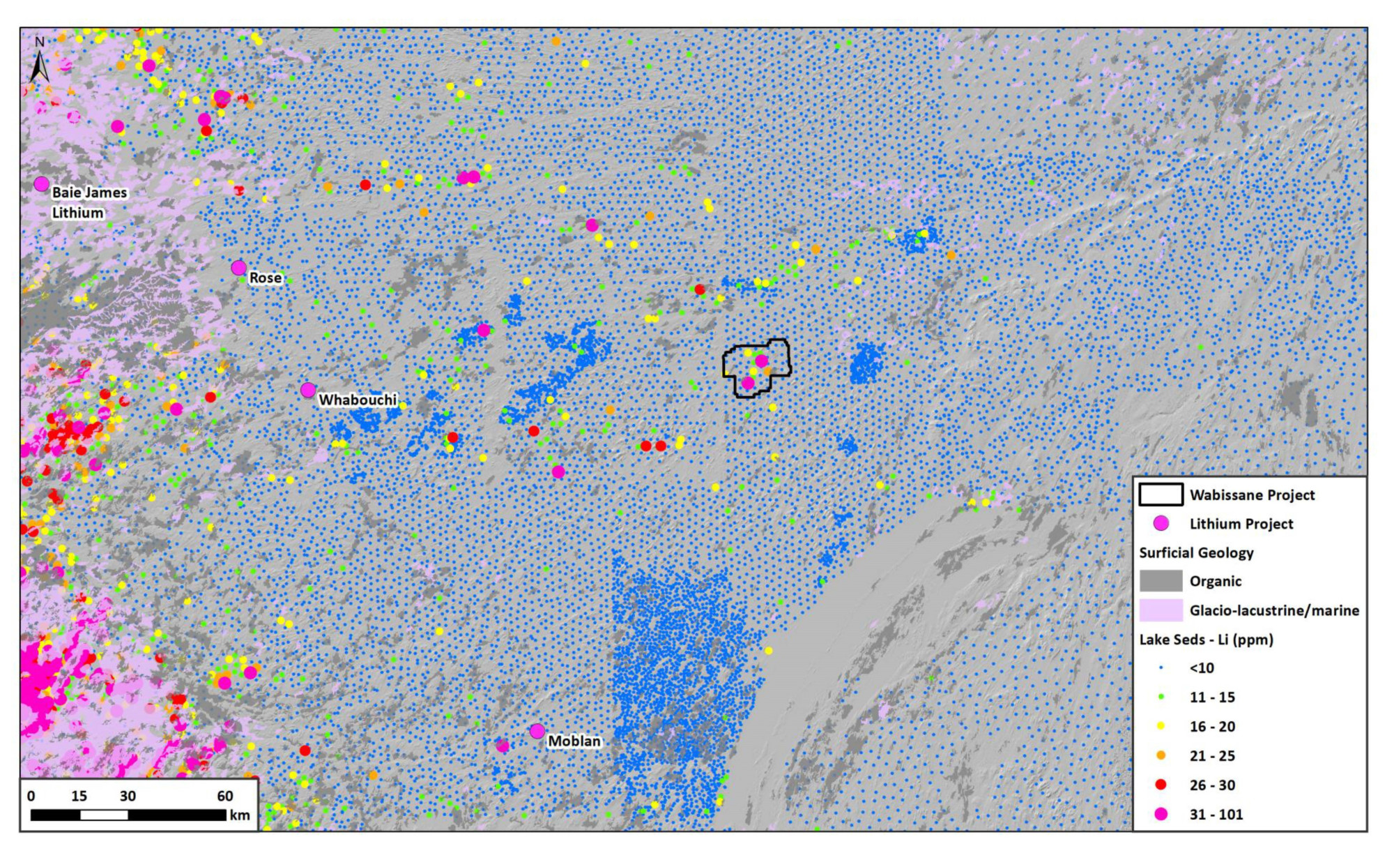
The Project lies within Opatica sub-province of Archean Superior Craton, adjacent to sub-province boundary with the Opinaca sub-province. Pegmatitic plutons are present within the Project area, intruding amphibolite grade gneissic sediments and volcanics. Major lithium Projects within the region include James Bay Lithium (40.4Mt at 1.4% Li2O), Rose (34.2Mt at 0.9% Li2O), Whabouchi (36.6Mt at 1.48% Li2O) and Moblan(12Mt at 1.4% Li2O). The Project is located immediately east of 2019-2022 MERN government mapping Project in the Lac des Montagnes and Nemisacau areas, which identify key lithological suites related to pegmatite mineralisation. There’s an opportunity to identify these lithologies at the Wabissane Project. Detailed magnetic surveys only partially cover the Project area and indicate potential for significant east-west structures across the Project area. Anomalous Li-Cs-Rb lake sediment geochemistry exists on the property and is coincident with pegmatitic granitoids. The landscape dominated by till, a 1st derivative of bedrock source, making it ideal for drift exploration and a first pass regional till sampling program.
Exploration History
The area is virtually unexplored, with a single high resolution aeromagnetic survey filed over the northern portion of the property.
Summary of exploration activities conducted by Kenorland Minerals
Since acquiring the Project in March 2023, a LIDAR survey was flown by Kenorland in the summer of 2023 to aid in surficial geological interpretation and planning of systematic geochemical surveys. Kenorland completed a geochemical soil sampling program during the 2024 summer field season.