LOCATION
British Columbia, Canada
SIZE
5,131 ha
STAGE
Available
DEPOSIT TYPE(S)
VMS, Au-rich Polymetallic Quartz Veins
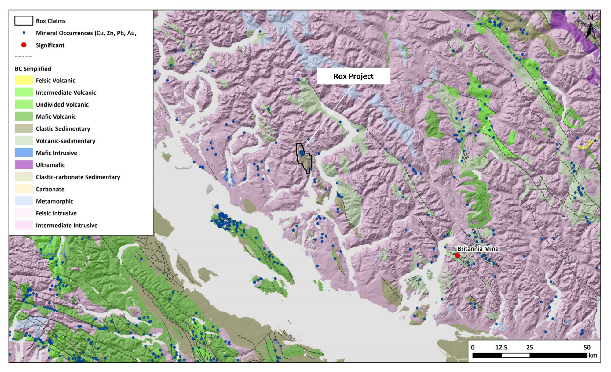
The 5,131 ha Rox Project in southwestern British Columbia was acquired through staking in 2022, which hosts a known VMS (Cu-Zn-Pb-Ag-Au) mineralised system within prospective geology close to infrastructure. The Project is underlain by a 15km long, northwest trending pendant of volcanic-sedimentary rocks of the Lower-Middle Jurassic Bowen Island Group within Cretaceous intrusive rocks of the Coast Range Plutonic Complex.
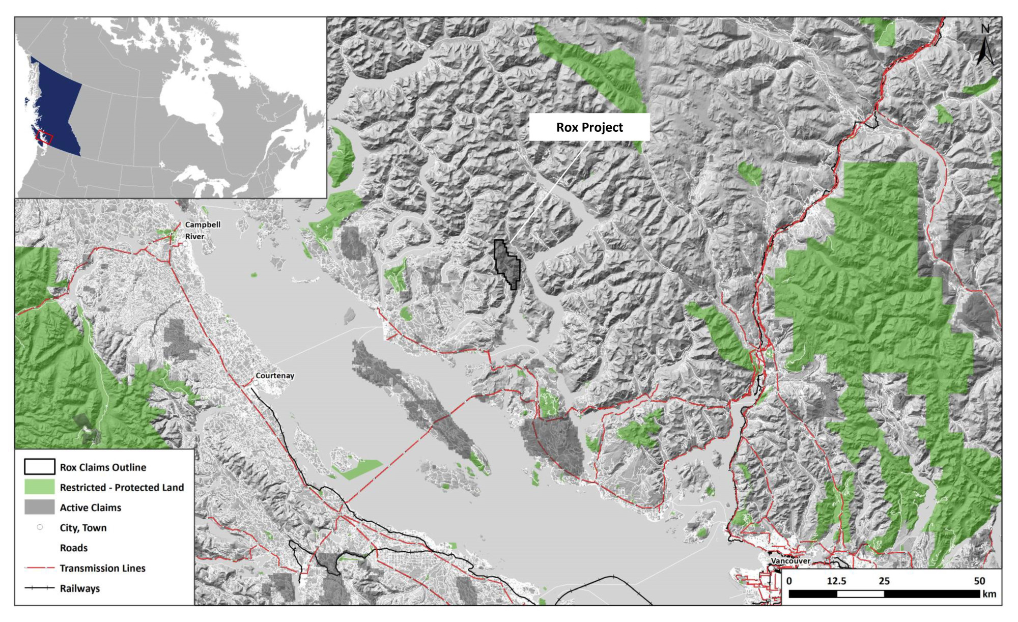
Location and Access
The Project is located approximately 35km northeast of Powell River in southwestern British Columbia. Forestry road networks gains access to the Project, with favorable infrastructure nearby including power transmission lines and population centres at Powell River for goods and services.
Geology and Mineralisation
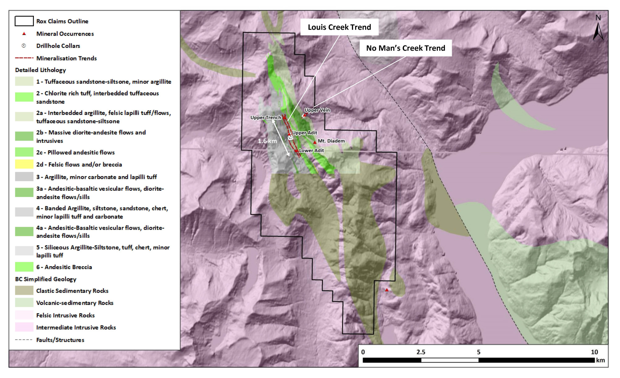
The Project area is underlain by volcanic-sedimentary rocks of the Bowen Island Group, a metamorphosed sequence of siltstone, tuffaceous sandstone, andesitic to basaltic flows, lapilli tuff and minor chert and carbonate rocks. Intense structural deformation developed north-northwest trending shear zones parallel to tight, moderate to steep, north- plunging folds characterized by penetrative axial planar cleavage crosscut by later shear zones trending east-northeast and steeply dipping. Both sets of shear zones are known to host mineralisation within the Project.
Two distinct styles of mineralisation have been documented within the Rox Project. Massive to semi-massive sulphide lenses are controlled by both stratigraphic contacts and shear zones, consisting of sphalerite-galena-chalcopyrite-pyrrhotite±arsenopyrite. Historical exploration campaigns of prospecting, trenching and limited drilling between two old adits has traced the Lois Creek Cu-Zn-Pb-Ag-Au mineralisation for a strike length of 1.6km trending north-northwest. The second style of mineralisation is shear controlled, narrow Au-rich polymetallic quartz veins trending northeast. The No Man’s Creek Au-vein has been traced for 500m, hosted within silicified and argillic (clay) altered volcanic and sedimentary rocks, but also extend into plutonic rocks along the northeastern extents.
Exploration History
The Rox Project area has received intermittent mineral exploration work since the 1920’s. Prior to the 1950’s, prospecting and mapping identified the known mineral occurrences along the Louis Creek and No Man’s Creek trends when short adits were driven at the main showings. Since the 1950’s various campaigns have included mapping and prospecting, soil and stream sediment sampling surveys, ground geophysical surveys (magnetic and EM), and limited diamond drilling at the Lois Creek Upper Adit Zone (1967 and 1984), and No Man’s upper quartz vein (1996).
Summary of exploration activities conducted by Kenorland Minerals
Since staking of the Project in November 2022, Kenorland has begun compilation and digitization of historical geochemical surveys and drill hole data within the Project area. A modern airborne time-domain electromagnetic survey (TDEM) was completed over the Project during Q4 2023.