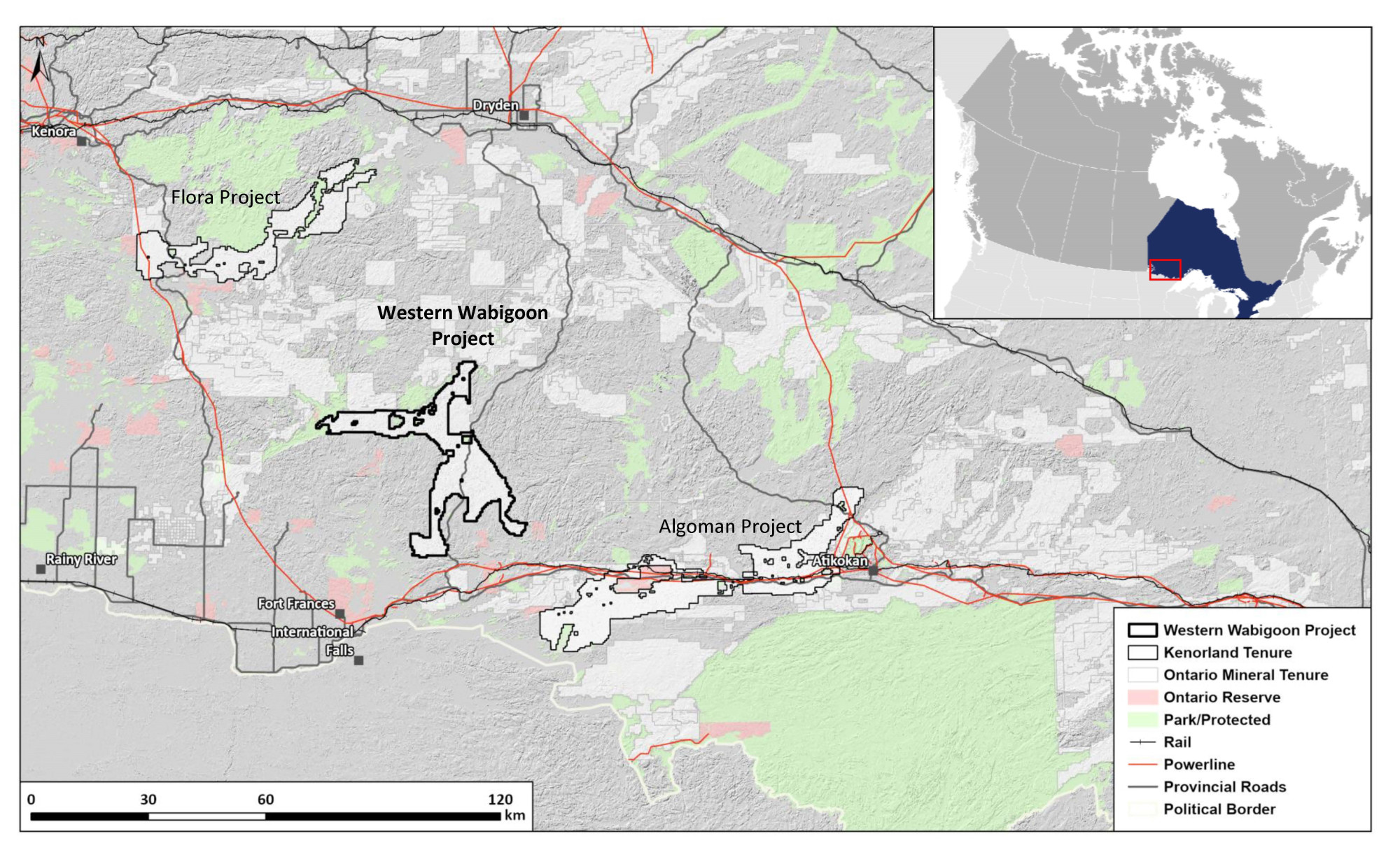
Since staking of the Project in April 2023, Kenorland has completed the compilation and digitization of historical exploration data within the Project area. A LIDAR survey was flown by Kenorland in the summer of 2023 to aid in surficial geological interpretation and planning of systematic geochemical surveys.
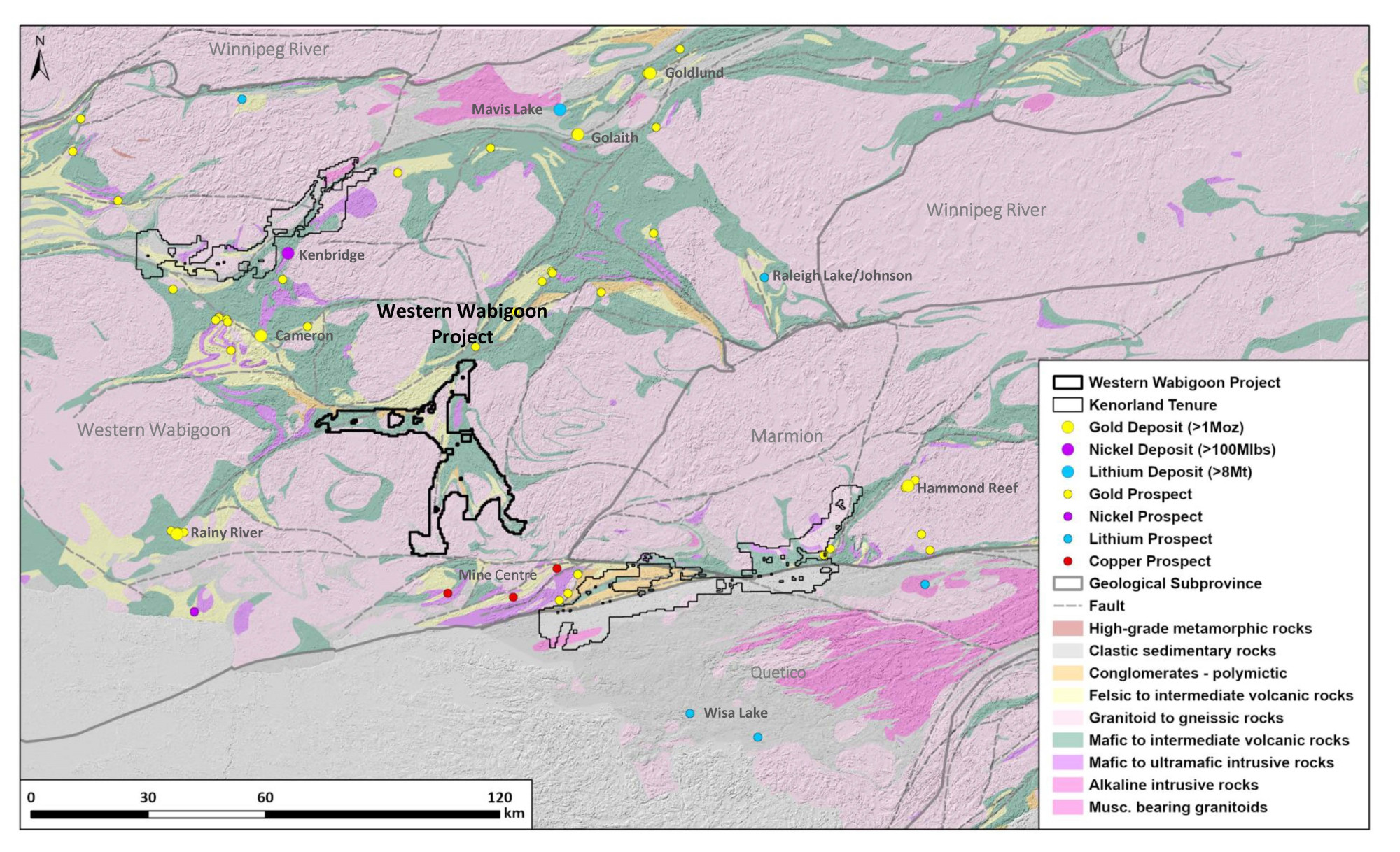
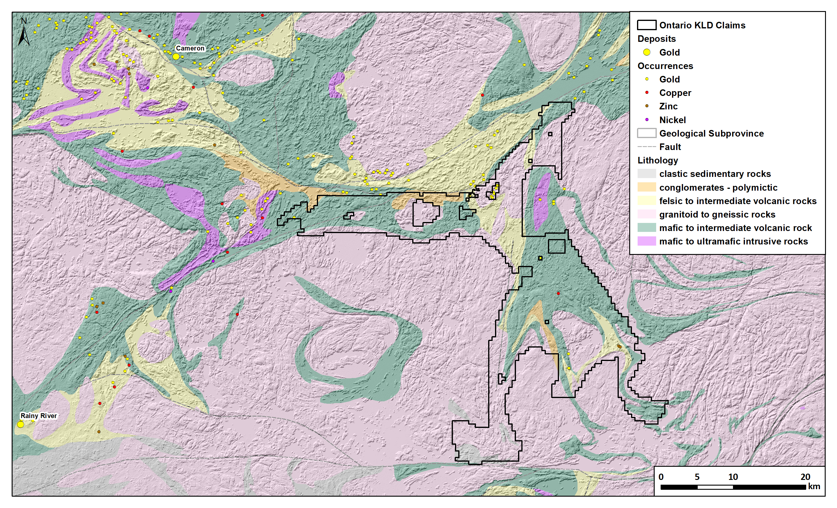
During the summer 2024 field season, systematic, geochemical screening of the Western Wabigoon Project included the collection of approximately 2,820 till samples (1000 m x 200 m sample spacing) covering the property. A significant, approximately 19 km trend of gold-in-till anomalism follows the southwest-northeast trending Manitou-Dinorwic Deformation Zone (MDdz) that transects the northern portion of the property. Within that trend, the W1 target (see figure in Gallery Section) is defined by continuous high tenor gold-in-till results, with Au-As±Sb-Te-W metal associations. A second zone of strong geochemical anomalism, located 6 km along strike to the southwest, the W2 target (Au-As-Sb), is concentrated where the MDdz orientation changes from a southwest-northeast trend to east-west. The W3 target (Ag-Mo-Te-W±Au-Cu), located 5 km to the southeast follows a regional contact between mafic volcanic rocks and gabbro intrusive rocks.
In 2025, infill till sampling further refined multiple coherent, high-tenor gold-in-till anomalies across the W1, W2, and W3 target areas. At W2, heavy mineral concentrate HMC analysis returned normalized gold grain counts of up to 251 grains per sample along a 4 km trend, reinforcing its significance as a priority for 2026 follow-up, including diamond drilling. Surface work has confirmed gold mineralisation along the historical Sorry Mac trend—now part of the W2 target—with rock samples up to 7.75 g/t Au and a significantly expanded footprint.
Planning for the 2026 field campaign is under way with up to 5,000m of diamond drilling proposed, designed as a series of fences to test key structural intersections associated with strong gold-in-till and gold grain anomalies, focusing on the priority W2 target of the Western Wabigoon Project.