Location
Alaska, USA
Size
15,834 ha
Stage
Discovery
Deposit Types
Orogenic Au
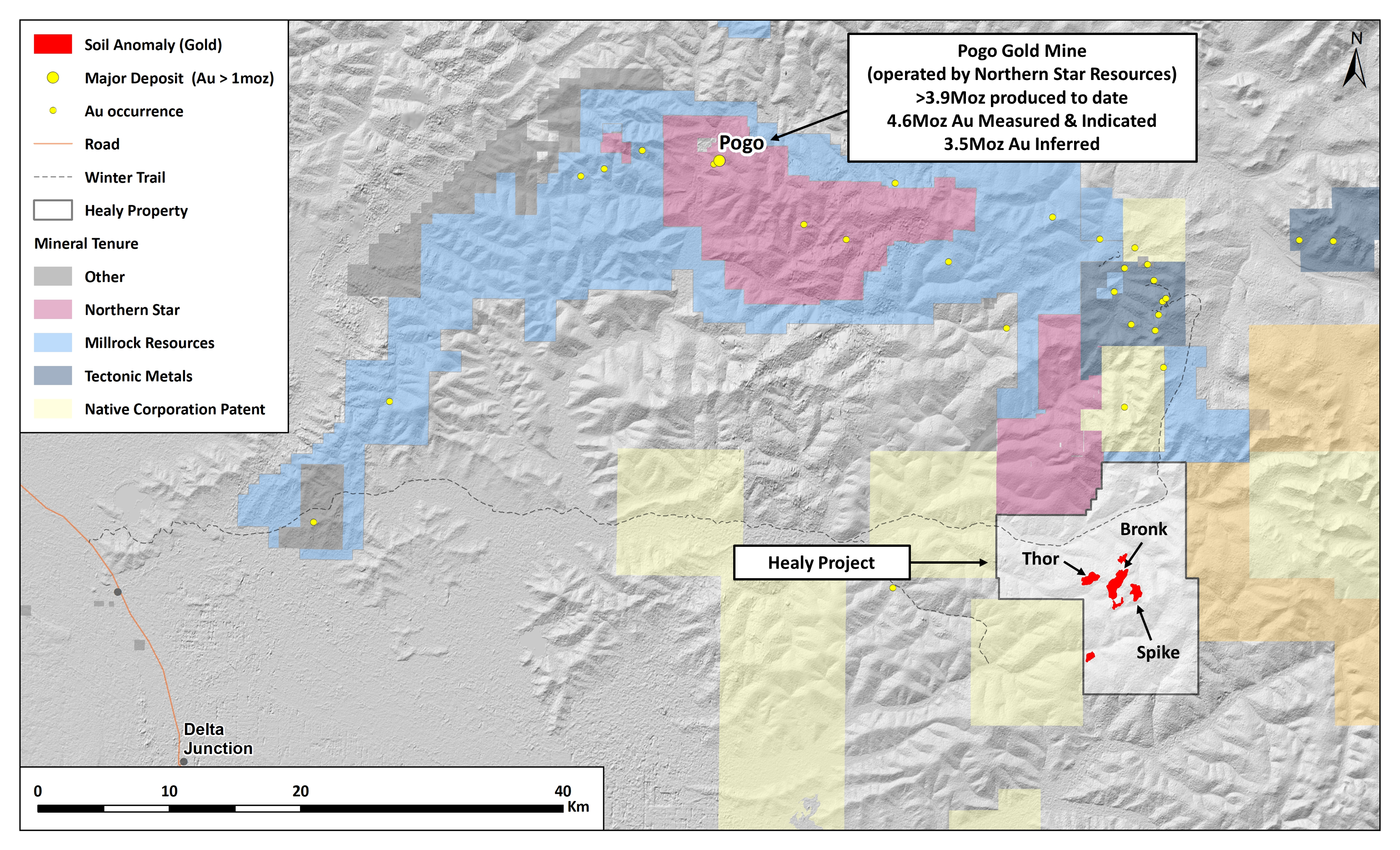
Located in the prolific Goodpaster Mining District of Alaska, the Healy Project covers an extensive mineralised gold system within an 15,834 hectare land package. The Healy Project was first identified and staked in 2011 by Newmont Corporation (Newmont, formally Newmont Mining) following a systematic screening of The Tintina Gold Belt in Alaska through regional stream sediment geochemical sampling.
In 2018, Kenorland Minerals (formally Northway Resources Corp.) entered into an option agreement to earn up to a 70% interest in the Project by funding US$4 million in exploration expenditures over a period of four years.
Download Technical Report
Location and Access
The property covers 15,834 hectares of state-owned Alaska mining claims and is located approximately 180 km southeast of Fairbanks and 70 km east of Delta Junction, Alaska which offer all amenities to serve exploration and mining activities. The property can be accessed via winter trail or helicopter from Delta Junction.
Geology and Mineralisation
The Healy Project is located within the Goodpaster Mining District, which is part of the Tintina Gold Province; host of significant deposits such as Donlin Creek, Fort Knox, Pogo, Coffee, Sheelite Dome and Dublin Gulch, and spans across central Alaska, southern Yukon Territory and into northern British Columbia. The property straddles a regional geologic boundary between metamorphic basement rocks and Cretaceous igneous rocks, which is spatial associated with many of the gold occurrences in the district, including the Pogo Gold Mine (Northern Star Resources) and the Tibbs Project (Tectonic Metal Inc.). The Project also lies within a major northeast trending structural corridor, the Black Mountain Tectonic Zone (BMTZ), which links the regional Tintina and Denali Fault Zones that bound the Yukon-Tanana Terran to the north and south, respectively. The BMTZ is like other major north-east trending structures in the Tintina such as the Shaw Creek, Mt. Harper, Ketchumstuck and Sixtymile fault systems, all of which are associated with major mineral systems and occurrences.
Within the Project area, gold mineralisation is structurally controlled by two main deformation events; mid-Mesozoic metamorphism and ductile deformation forming regional penetrative fabrics and low angle thrust faults offset by the mid Cretaceous northeast trending, steeply dipping BMTZ fault system. Gold mineralisation at Healy is believed to be associated with movement along the BMTZ fault system through the brittle-ductile transition. Gold anomalism can be characterized by gold-arsenic ± silver-antimony metal associations, defined by multiple, often over-printing sulphidation events containing varying concentrations of pyrite, pyrrhotite, arsenopyrite and stibnite. Gold mineralisation is associated low angle thrust faults and high angle mylonitic shear zones containing weak to strong quartz-carbonate stockwork veining and localized massive quartz veins. Pervasive alteration consists of silica-sericite-iron carbonate ± fuchsite-chlorite-calcite, forming wide alteration envelopes along the faults systems, commonly containing 1-5%, locally up to 25% total sulphide.
Exploration History
The Healy Project was originally identified as a multi-catchment gold anomaly through Newmont’s proprietary bulk leach extractable gold (BLEG) stream sediment sampling technique during a regional survey of eastern interior Alaska. The Project was staked in 2012 followed by limited early-stage exploration including ridge-and-spur and wide-spaced grid soil sampling, geologic mapping and prospecting, and four shallow Shaw back-pack drill holes all completed by Newmont. The targets generated from these exploration campaigns remained untested by diamond or reverse circulation drilling prior to the optioning of the property by Kenorland Minerals Ltd. in 2018.
Summary of exploration activities conducted by Kenorland Minerals
Kenorland began exploration work in 2018 with additional surface geochemical sampling involving collection of C-horizon soil samples confirming historical results and expanding the soil grid to the south and southeast. This led to an initial reconnaissance drill program in 2019 including ten shallow reverse circulation (RC) drill holes which intercepted widespread low-grade gold mineralisation within the Bronk target area.
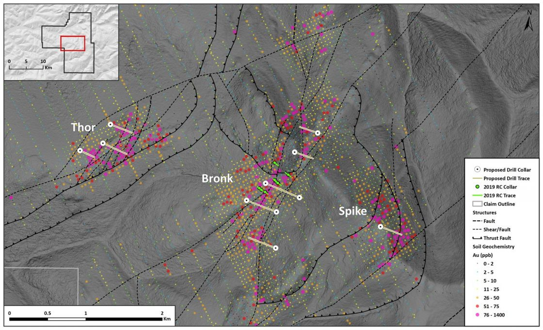
In 2020 further geochemical and geophysical surveys advanced the Healy Project. Infill C-horizon soil sampling was completed over seven target areas at 50 meter spacing. Geophysical surveys included a helicopter-borne magnetic and radiometric survey, ground-based magnetic survey, and a very low frequency electromagnetic (VLF-EM) survey covering five target areas. In addition, 10 survey lines of induced polarization (IP, resistivity) were completed over the Thor, Bronk and Spike target areas. The 2020 field campaign aided in the definition of drill ready targets for the following 2021 summer drill program.
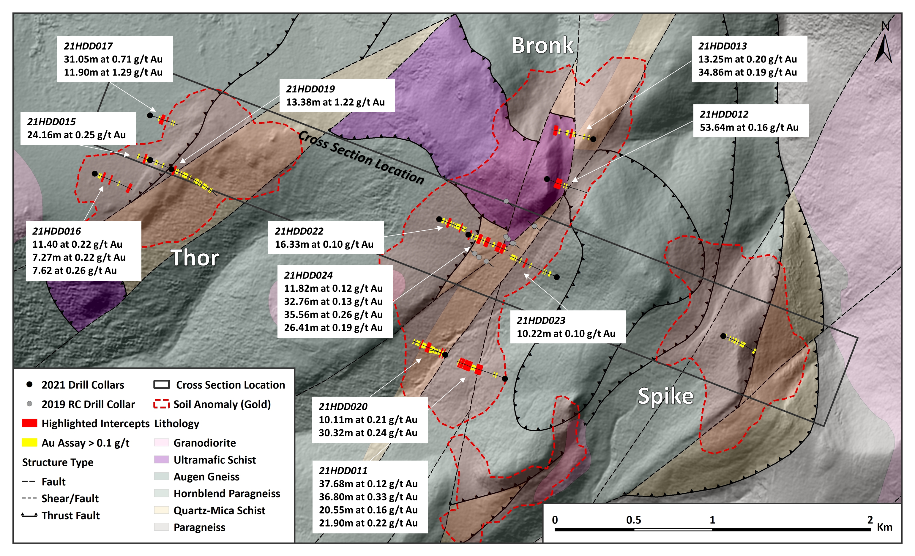
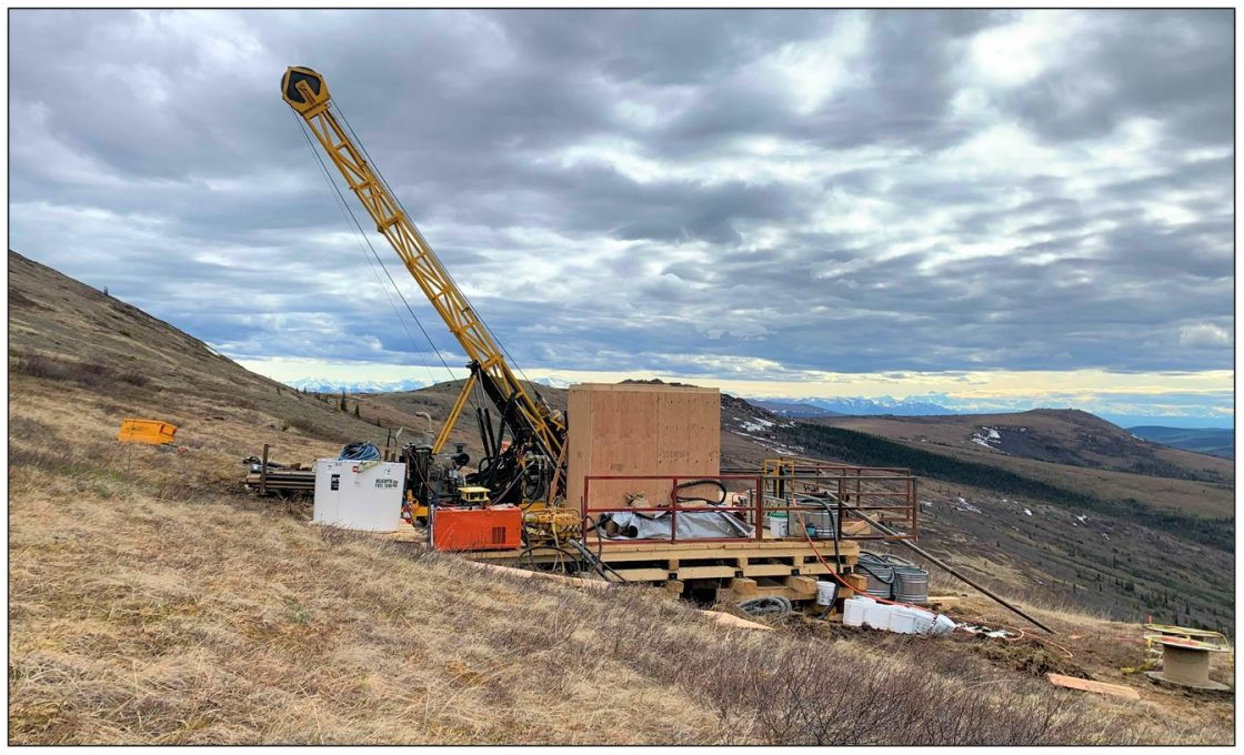
Between June and September 2021, the Company completed its maiden diamond drill program at Healy, including 14 drill holes (5,247m) which tested three areas defined by strong gold in soil anomalism at the Thor, Bronk, and Spike targets. In addition to the diamond drill program, a high-powered induced polarization (Titan™ IP) survey and magneto-telluric (MT) survey was completed across a 5km line which transects the Thor, Bronk and Spike target areas. Anomalous Au was intersected, associated with As and Sb bearing disseminated to breccia fill sulphides in conductive, chargeable structural zones.
During the summer of 2023 an extremely low frequency electromagnetic (ELF-EM) ground geophysical survey was carried out over the Thor, Bronk and Spike targets to refine drill targeting along prospective structural trends.


