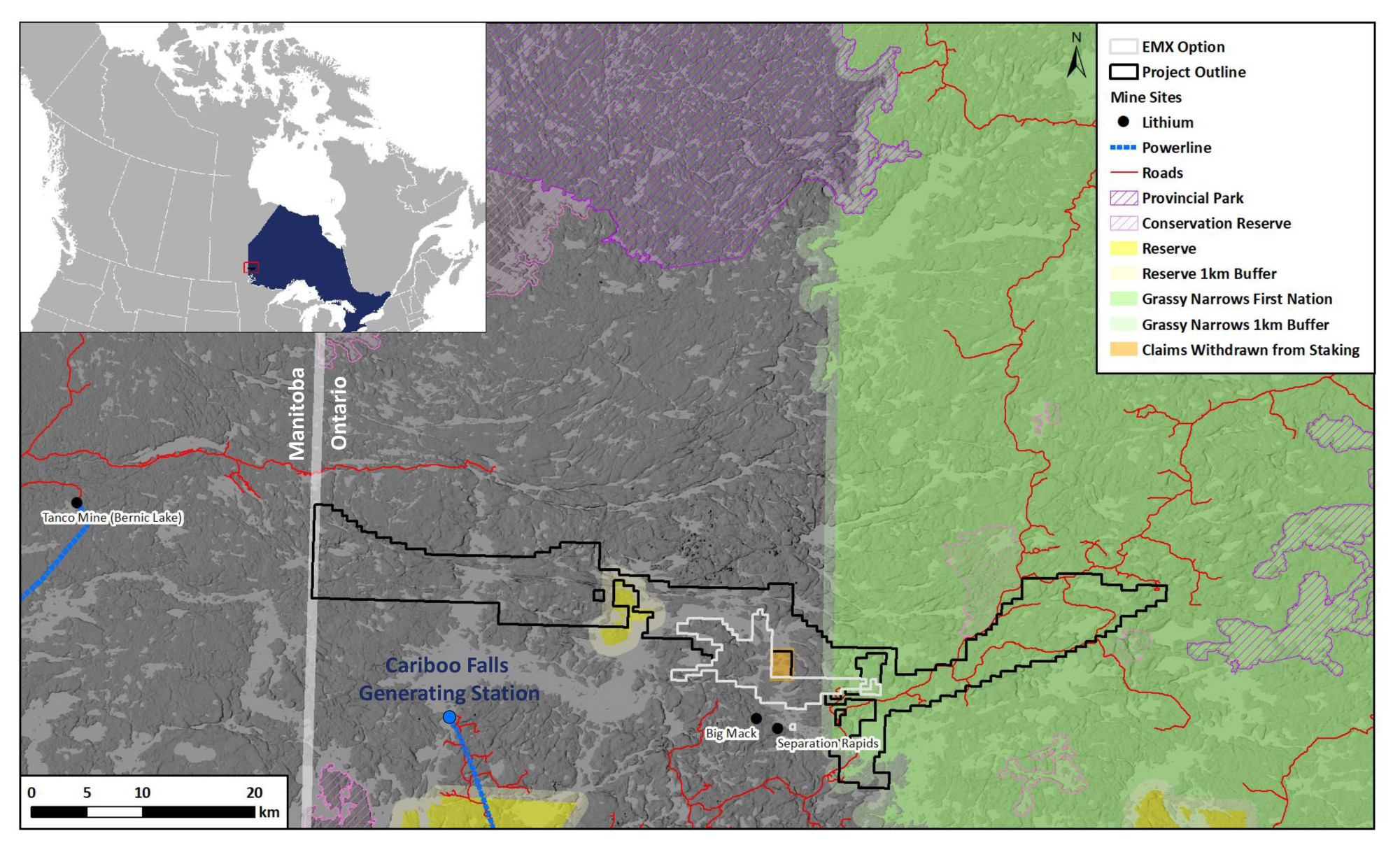
LOCATION
Ontario, Canada
SIZE
46,466 ha
STAGE
Grassroots
DEPOSIT TYPE(S)
Li-Cs-Ta Pegmatite
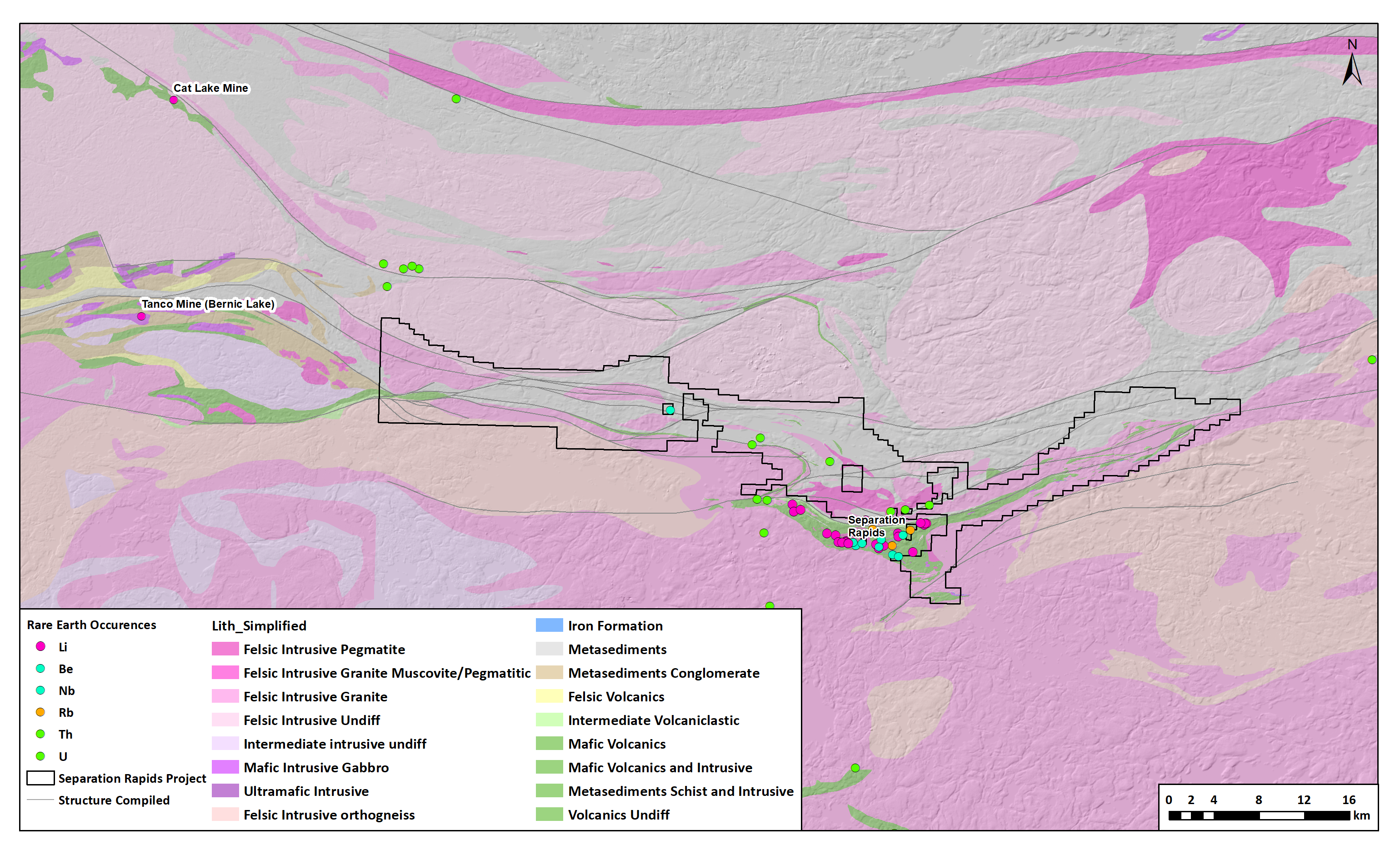
The Separation Lithium Project covers approximately 80 kilometers of the contact between the English River and Winnipeg River geologic sub provinces. This boundary is spatially associated with the Tanco Li-Cs-Ta pegmatite deposit in Manitoba, as well as the Big Whopper Li pegmatite in the Separation Rapids area. The presence of these two significant Li pegmatite deposits suggests that the entire English River – Winnipeg River domain contact is prospective for additional Li pegmatite mineralisation. The Separation Rapids Project was previously held under an option agreement with Double O Seven Mining Ltd., a private B.C. corporation. Kenorland is currently the 100% owner of the Separation Rapids Project.
Location and Access
The Project is located in northwestern Ontario 50km north of Kenora. The eastern portion of the property is accessible via logging road networks, and the Caribou Falls hydroelectric generating station is 10km south of the Project.
Geology and Mineralisation
The Project is situated along the major sub province boundary between the metasedimentary migmatite dominated English River and the felsic to intermediate plutonic dominated Winnipeg River sub provinces of the Archean Superior Province. Discontinuous metasedimentary and mafic to felsic metavolcanic rocks occur along the boundary as the Separation Lake metavolcanic belt (an extension of the Bird River volcanic belt in Manitoba). Deformation and metamorphism to amphibolite grade has produced a strong fabric, folding and high strain structural zones. Several large tonalitic to granitic intrusions occur in the area, including the evolved pegmatitic granites and pegmatite dykes hosting the Li-Cs-Ta pegmatite Separation Rapids deposit immediately to the south of the Project.
Exploration History
Limited historical exploration work has been undertaken in the Project area, and the majority of which has focused on the eastern portion of the property immediately north of the Separation Rapids LCT pegmatite deposit. A total of 8 drillholes have been completed on the Project which originally targeted the gold potential of mafic volcanic units. Prior to staking of the Project no property scale systematic geochemistry surveys have been completed.
Summary of exploration activities conducted by Kenorland Minerals
In 2022, the Company completed a regional till geochemical survey focused on LCT pegmatite systems, covering a large portion of the 46,466-hectare property. Results from the 1,183 till samples collected identified three priority target areas defined by anomalous and coincident lithium and cesium in till. A detailed follow-up geochemical survey was completed over the priority target areas in the summer of 2023.